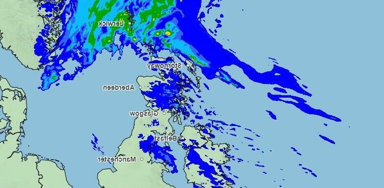
BRITS have today been warned to brace for periods of heavy rain and wind before they can enjoy a sunny weekend.
It'll be wet and blustery in parts of the UK today before clearing by Saturday.
The worst of the weather will lash northern Scotland and the Northern Isles.
A dryer day is projected further south, where isolated fog and biting frost will "clear to leave an increasingly cloudy and breezy, but mostly a dry day", the Met Office said.
The forecaster said: "Light rain and drizzle pushes northeast across Scotland. Many other areas dry with variable cloud. Mostly frost free."
The weekend will brighten up, with Saturday bringing sunny spells.
read more on weather
Date snow could fall as Met Office warns of ‘stratospheric warming’
Snow warning with yellow alert for travel chaos and icy roads
Similarly, Sunday will be "mostly dry, with some sunny spells" after a "breezy and damp at times" start.
Meanwhile eight flood alerts have been issued spanning across the UK.
The alerts are in place for swathes of Hampshire as well as East and West Sussex, where groundwater floods have been prolonged.
With a relatively dry February forecasted, many of those warnings are likely to wane as the days and weeks progress.
Most read in UK News
Expert reveals why Nicola Bulley's dog ran back & forth when she went missing
Nicola cops ARE hunting shabby red van – I saw the vehicle, says key witness
Missing Nicola was reported missing 2 HOURS after she was last seen
Nicola cops told to search river close to where teen vanished 45 years ago
A Sudden Stratospheric Warming (SSW) will likely take place as March looms.
An SSW refers to a sudden warming up in the stratosphere, the area found between six and 30 miles above the earth’s surface.
The phenomenon resulted in 22 inches of snowfall in parts, with a devastating £1.2 billion hit to the UK economy.
In a recent blog post, The Met Office said: "In the meantime, it is important to remember that the occurrence of an SSW does not always equate to a ‘Beast from the East’ type scenario even though this happened in 2018.
"For example, in 2019, there was an SSW but little impact on the weather for the UK and NW Europe.
"The current extended range forecast for mid-February suggests that the most likely scenario is for broadly changeable weather with westerly conditions and influxes of wind and rain at times, particularly in the northwest.
"Temperatures are likely to be around average through mid-February. We will be updating forecasts with a close view on late February and early March as the SSW unfolds."
Source: Read Full Article


