Save articles for later
Add articles to your saved list and come back to them any time.
A search-and-rescue group in British Columbia advised hikers to use a paper map and compass instead of street map programs after it said two hikers had been rescued by helicopter after likely following a trail that did not exist, but that appeared on Google Maps.
The group, North Shore Rescue, said on Facebook that on November 6 Google Maps had removed the non-existent trail, in a very steep area with cliffs north of Mount Fromme, which overlooks Vancouver.
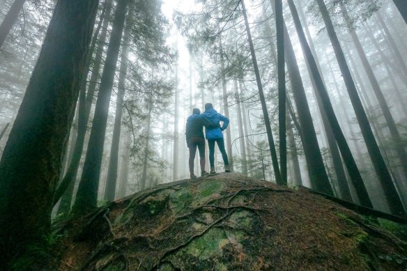
A forest walk on Mount Seymour, North Vancouver in British Columbia.Credit: iStock
The group said it had deployed a helicopter and a rope rescue team on November 4 to the back of the mountain, which is 1185 metres high and covered in temperate rainforests, to help a stranded hiker who did not have a light and could not be seen below the dense tree canopy.
The group said it had recently put up signs that warned “Wrong Way Dangerous Cliffs” to underline how dangerous the area was.
In September, the group rescued a hiker who called to say he was on a cliff and was unsure how long he could hang on. Two years earlier, a hiker had fallen to his death from the same spot, the group said.
North Shore Rescue said the hikers in the September and November rescues “may have sought to follow a trail on Google Maps that does not exist”.
The group said “it is simply not appropriate” to use apps such as Google Maps for the wilderness, though apps specifically designed for trails, such as CalTopo and Gaia GPS, were acceptable.
People can submit suggested edits to Google Maps for wrong or missing data. Google does not provide a timeline for how long it takes to process those suggestions. It was unclear how the trail had appeared on Google Maps in the first place.
Maggie Peikon, a spokesperson for the American Hiking Society, said people should always research a trail so that they know what to expect about the terrain, elevation gain and distance.
This can be done by looking up information on apps and websites specifically designed for hikers, and on social media sites.
This article originally appeared in The New York Times.
Get a note directly from our foreign correspondents on what’s making headlines around the world. Sign up for the weekly What in the World newsletter here.
Most Viewed in World
From our partners
Source: Read Full Article