UK weather: Widespread rain to hit UK early in the week
We use your sign-up to provide content in ways you’ve consented to and to improve our understanding of you. This may include adverts from us and 3rd parties based on our understanding. You can unsubscribe at any time. More info
A weather system responsible for the turbulent Beast from the East in 2018 is underway, the Met Office has confirmed. Sudden stratospheric warming (SSW) has started and has been blamed for extreme sub-zero blasts over previous years. These include a period of bitterly cold snow showers between 2009 and 2010, then again in March 2013 and lastly the deadly Beast from the East just five years ago. While the SSW can lead people to believe it brings milder temperatures to the UK’s shores, it actually does the opposite.
The Met Office says SSW occurs when rapid warming takes place between 10km and 50km above the Earth’s surface. It’s so high up that the warming effects cannot be felt, but it does cause a knock-on effect in weather conditions weeks later.
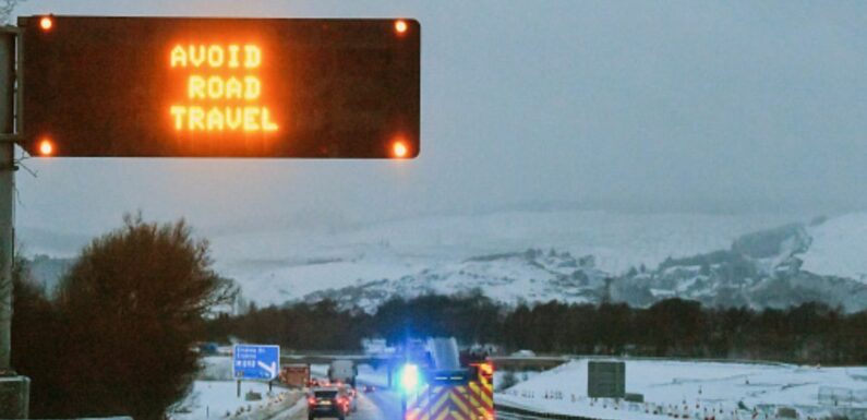
It’s these brutal and often dangerous conditions which come in the form of plummeting temperatures, snow and storms that can often bring the nation to its knees with transport networks ground to a halt, icy pavements and freezing temperatures putting vulnerable people at risk.
While SSW doesn’t happen every year – it is currently taking place at the moment. And the Met Office has detailed what it’s doing to the jet stream and what it means for the UK’s forecast in the next month.
In a blog, Met Office experts said: “A sudden stratospheric warming is underway, but only a minor one. The warming is expected to peak towards the end of January. The strong westerly winds high over the Arctic, called the stratospheric polar vortex, have weakened and the vortex is partially collapsing.


“However, the polar vortex has been unusually strong so far this year and although there has been a minor SSW, the winds are expected to rebound quickly, recovering to speeds around normal for the time of year.”
While this weather event can cause detrimental impacts to the UK, it doesn’t always work out that way. According to the experts, while in 2018 it brought the Beast from the East and all its wrath, in 2019 it had no impact.
So, safe in the knowledge this system takes a while to materialise, forecasters have waded in with predictions for the coming weeks, dispelling any chance of widespread snow for the foreseeable future.
Its blog continued: “Forecasts at present show only minor impacts are expected and that other factors, such as La Nina and the Madden Julian Oscillation are also likely to influence our weather over the next few weeks.”


La Nina is a term used to describe episodes of cooler than average sea surface temperatures and the Madden Julian Oscillation is defined as an eastward spread of enhanced and suppressed tropical rainfall over the Indian and Pacific Ocean.
“Our predominant weather is expected to come from the west with wet and windy periods,” it said. “The unsettled conditions are expected to impact the north and west of the UK at the start of February as frontal systems push south across the country, weakening as they go with parts of the south remaining largely dry.
“Temperatures will stay around average for many.”
This pattern is set to continue throughout February according to the leading forecaster which predicts heavy rain at times in the north and west. The south and east are set to see drier periods with lighter rain.
The blog added: “A brief spell of more settled conditions is possible in the middle of the period, bringing a greater risk of overnight frost and freezing fog, especially under clear skies with light winds. Temperatures are expected to be generally at or slightly above average, although a brief colder spell remains possible.”
Maps from WXCHARTS show a brief period of snowfall is expected over Scotland tomorrow night but other than that, the UK’s weather outlook remains largely uneventful. Temperatures for the next week range from between 3C and 10C in the south, 0C to 4C in Scotland and 1C and 6C in Wales.
The outlook for the rest of this week as detailed by the Met Office for Wednesday to Friday says: “Cloudy across northern areas with showers or some longer spells of rain, heavy at times. Mostly dry in the south. Very windy across northern Scotland early Wednesday.”
Source: Read Full Article