Save articles for later
Add articles to your saved list and come back to them any time.
Rising sea levels along Victoria’s South Gippsland coast have spurred moves to stop a housing sprawl at seaside holiday towns to reduce exposure to climate-change related disasters.
South Gippsland Shire wants to rein in urban construction and stop expansion beyond current town boundaries at Sandy Point, Waratah Bay and Venus Bay, which attract hordes of holidaymakers each summer.
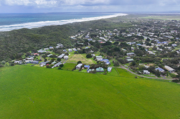
Farmland earmarked for potential future development in Venus Bay. Credit: Joe Armao
The council is moving towards preventing subdivisions and limiting building to single dwellings on vacant lots, preserving low-lying farmland that had been earmarked for subdivision.
South Gippsland Shire councillor Sarah Gilligan, whose ward covers the three towns, said modelling showed the land designated for potential development would be frequently inundated in coming decades due to sea-level rise. And roads would be more cut off by storm surges within the coming 15 years.
Gilligan said the council needed to take decisive action to protect people, homes and infrastructure.
“If we do nothing we will have some really catastrophic events,” she said.
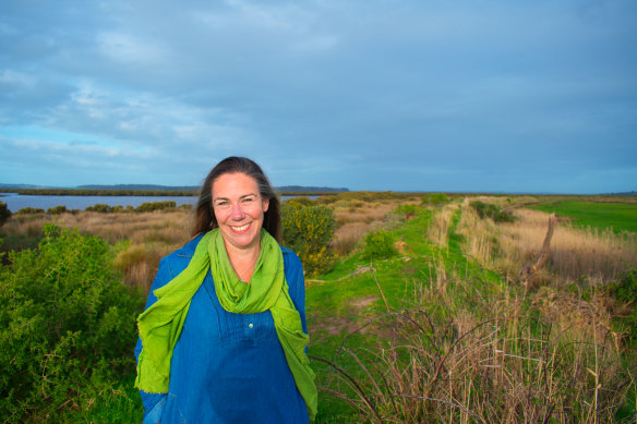
South Gippsland Shire councillor Sarah Gilligan.
Gilligan said limiting development to one dwelling per existing vacant residential lot would also limit the number of people exposed to inundation, floods and fire risk.
Modelling shows much of the area earmarked for potential future urban expansion in Venus Bay, Waratah Bay and Sandy Point would be subject to inundation under a 0.8 metre sea-level rise by 2100.
The 0.8 metre sea-level rise benchmark remains state government policy even though the Intergovernmental Panel on Climate Change updated its projections to 1.1 metres by 2100 more than two years ago.
The Victorian government has confirmed it was reviewing and updating the 0.8 metre sea-level rise benchmark.
Gilligan said levee walls designed to provide drainage in agricultural land were also beginning to fail in other parts of Venus Bay.
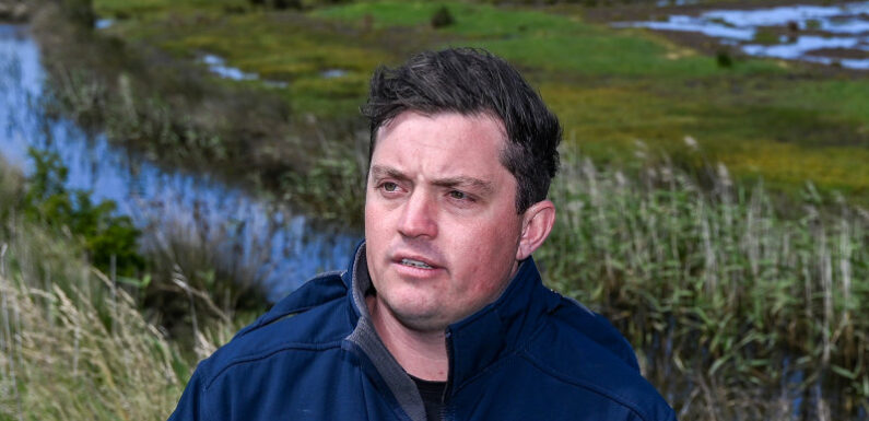
South Gippsland mayor Nathan Hersey said it would be irresponsible for the council to allow houses to be built in greenfield sites likely to be exposed to natural disasters.
“Why would we go and develop land that will be inundated according to the current mapping?” he said.
South Gippsland Shire figures show Venus Bay still has about 600 vacant residential lots that can be developed. But the council’s recently adopted coastal strategy warned a “serious development intensification threat” was foreseeable.
South Gippsland Shire mayor Nathan Hersey at one of the levee walls in Venus Bay. Credit: Joe Armao
It said now was the time to discourage or prohibit subdivision of residential lots or building more than one dwelling per lot to minimise the risk of exposing more people to coastal hazards.
Hersey said the coastal strategy’s proposed changes to the planning scheme were modest but would provide certainty.
However, the changes would need state government approval before they could proceed.
The coastal strategy said allowing development to continue would result in “more cumulative exposure to risk to people and property over time.”
“Removing township expansion areas is an effective way to reduce the potential exposure of more people to coastal hazard risk in the future.”
House prices at Venus Bay have risen from a median of just under $400,000 at the beginning of 2020 to $664,000 in October 2023, according to property data firm Core Logic. There was no data available for Sandy Point or Waratah Bay.
At Sandy Point, the council has already rejected a proposal to convert a caravan park into a residential housing development due to concerns about inundation.
At last month’s Municipal Association of Victoria meeting, South Gippsland Shire moved a motion calling on the state government to strengthen planning rules in land subject to inundation overlays and update flood mapping.
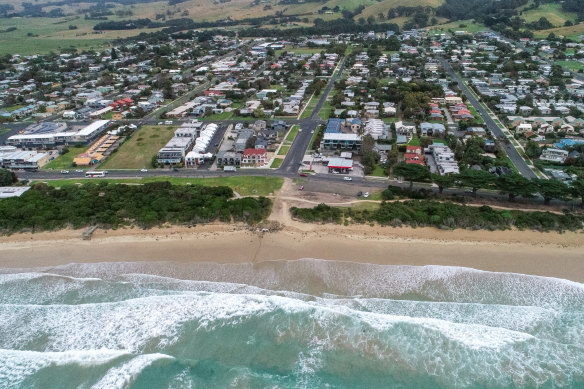
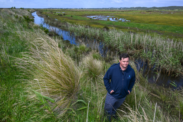
Sea level rise will affect many communities along the Victorian coastline. Credit: Joe Armao
“Out-of-date flood maps mean that buyers may not have the information they need to make informed, risk-based decisions about their potential land purchase,” the council said.
Coastal management expert Geoff Wescott said councils may need to consider innovative responses to development in coastal areas, including time-limited building permits.
Councils could consider putting movable, prefabricated houses in areas that will be subject to inundation or flooding in future to minimise exposure to disasters for residents.
“Councils could grant a permit for 50 years, and it could be conditional on being able to remove the dwelling,” Wescott said.
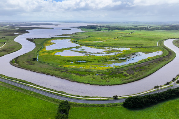
A swollen Anderson Inlet at Venus Bay. Credit: Joe Armao
Although local governments derive more income from rates when they have bigger populations, Wescott said coastal councils feared they may be sued if they allowed property owners to build on land that was at risk of inundation.
He urged the state government to revise its sea level rise benchmark.
Australian Coastal Councils Association committee member Tom Crook said the coastline was a “dynamic environment” but climate change was exacerbating the risks.
“Storms are getting more severe. Tidal influences are getting more pronounced,” he said. “The impact we’re seeing on our coasts are unprecedented.”
A spokesman for the state government said Victoria was preparing for coastal climate change hazards and had “well established planning controls in place”. The government also confirmed it was reviewing and updating the 0.8 metre sea level rise by 2100 benchmark.
Start the day with a summary of the day’s most important and interesting stories, analysis and insights. Sign up for our Morning Edition newsletter.
Most Viewed in National
From our partners
Source: Read Full Article