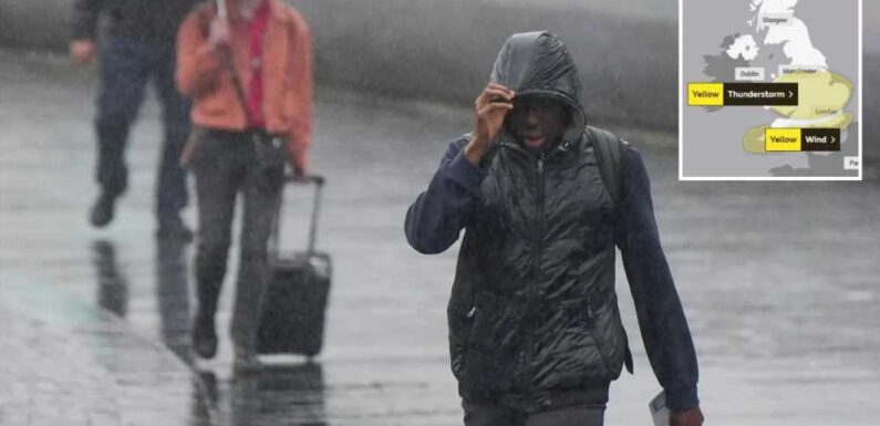
BRITS have been warned of travel chaos and power cuts today as yellow weather warnings are issued across the UK.
Gale force winds of up to 60mph and torrential rain are set to batter the south of England, threatening to rip out power lines and tear down trees.


The Met Office has issued a yellow weather warning for wind covering the south coast, including Brighton, Portsmouth and Plymouth.
It has been in effect from 4am and lasts until 6pm this evening.
Meteorologists have warned Brits the "unseasonably windy weather" could cause delays for high-sided vehicles on the roads, large waves on the sea front and travel disruption.
The Met Office said: "Gusts are likely to reach 50mph in some English Channel coastal areas with 55 to 60mph possible in the most exposed locations in the far southwest and, perhaps, a little higher in the very most exposed parts of coastal southern England such as the Needles.
Read More

Brits to be battered by 3 days of stormy weather with flood warnings

Unusual weather means your house could be invaded with poisonous spiders
"There will probably be some damage to a few buildings and structures from lightning strikes.
"Delays to train services are possible. Some short term loss of power and other services is likely."
Temperatures are set to remain mild throughout the day, hovering between 15C and 18C for most of the UK.
A second Yellow weather warning for thunderstorms is also in place from 9am and eases at 7pm.
Most read in The Sun

I was stabbed by drunken dad in stomach & hospitalised, says Anton Du Beke

This Morning star gives birth to baby girl after secret pregnancy

Poor holiday park lighting meant we didn't see drowning son, say parents

Woke charity asked me to change name of my pub – I thought it was a joke
"Along with the strong winds, the system will being some heavy rain," The Met Office warned.
"Within this area slow moving thunderstorms could lead to rainfall accumulations of 20-25mm within an hour.
"Some locations could see in excess of 40mm in a 2-3 hour period."
The yellow weather warning covers parts of London, Norwich, Nottingham, Manchester and Cardiff.
Lightning strikes will likely cause some damage to a handful of buildings, predicted forecasters.
Brits have also been urged to prepare for heavy rain and hail wreaking havoc on the roads.
Trains service delays and spates of power loss across the affected areas are also likely.
It is a second blow to train commuters currently navigating strike hell from drivers' union ASLEF until Saturday.
And, prolonged showers are due to stay until Monday August, 7, predict Met forecasters.
Meteorologist Phil Morrish said: "There will be another seven to 10 days of this unsettled weather as the jet stream comes in from the west giving us periods of rain and showers and moderate temperatures of 20C in the south and 17 to 18C in the north."
However a brighter outlook is on the horizon from August 7.
The forecast states: "August 7-14 looks warmer with sunnier conditions as the jet stream moves north allowing high pressure from the south to build up.
Read More on The Sun

What the rogue chin hairs really mean and when it’s a serious problem

Asda is offering a free cash bonus for shoppers for Christmas – how to get it
"Between August 10-14 normal temperatures of 20 – 25C in the south.
"The third week of August will see more warmth, 25C to perhaps 30C if high pressure takes hold."
WEATHER WARNINGS
What to expect
- Delays for high-sided vehicles on exposed routes and bridges likely
- It’s likely that some coastal routes, sea fronts and coastal communities will be affected by spray and/or large waves
- Some delays to road, rail, air and ferry transport are likely
- Probably some bus and train services affected, with some journeys taking longer
- Some short term loss of power and other services is possible
- Trees and temporary structures such as marquees and tents may be damaged
Source: Met Office
STAYING SAFE
Five tips for staying safe in a thunderstorm
- Check if your property is at risk – if so prepare a flood plan and an emergency flood kit.
- Stay safe in flooding – park your car outside the flood zone, store valuables and electrical devices high up, turn off gas, water, and electricity supplies.
- Secure loose items such as bins, plant pots, garden furniture, trampolines and lock shed doors.
- Is it safe for you to drive? If you must drive, slow down, use main roads, dipped headlights and keep a bigger gap between vehicles.
- During a power cut:
- Switch off all electrical appliances that shouldn’t be left unattended, ready for when the power comes back on.
- Leave a light on, so you know when the power cut has been fixed.
- Check to see if your neighbours are safe and if they have a power cut too. If they have power, your trip switch may have activated.
- If it's cold, wrap up warm and close internal doors to keep the heat in.
- Portable heaters are a good alternative if heating systems are down.
- Call 105 for information, it’s a free service for people in England, Scotland and Wales.

Source: Read Full Article