With another deluge on the way this week, the Bureau of Meteorology is concerned rainfalls of up to 100 millimetres could cause major flooding in Victoria.
While Melbourne is forecast to bask in sunny conditions and a maximum of 22 degrees on Tuesday, by Thursday the top temperature will drop back to the teens and “fairly heavy” rainfall will arrive.
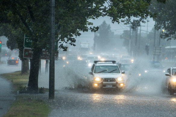
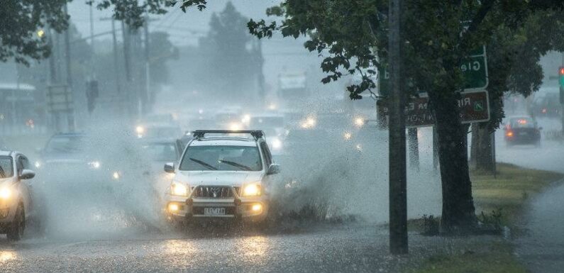
There could be similar scenes on Victoria roads by Thursday this week. Large amounts of rain created flooding across the Nepean Highway near St Kilda on Friday.Credit:Simon Schluter
The Bureau of Meteorology’s Christie Johnson said there will be moderate rain in north and west Victoria on Wednesday, before widespread falls of 20 to 50 millimetres across the state on Thursday.
The duty forecaster said there’s the chance of falls of between 60 and 100 millimetres on Thursday, in Victoria’s North Central, North Country and North-East regions.
Gusty winds are expected to hit Victoria on Wednesday night and continue through Thursday.
“There is also potential for some fairly heavy rainfall through the central district – through Melbourne – it will be very moist, so we are still expecting some pretty good rainfall,” Johnson said.
“We’ll be looking at whether we could see flash flooding … we may have a severe weather warning for heavy rainfall, but that’s still being assessed and it will be issued if required.”
The rain trough moving through Victoria is being caused by a large, low-pressure system forming in the south of the Great Australian Bight, which has extended a cold front that would move through the state on Wednesday.
Johnson said the cold front would interact with an inland trough that has carried a lot of additional tropical moisture through NSW and into Victoria.
Moderate flood warnings remain in place for the Avoca, Loddon and Murray rivers.
The additional rain this week could cause significant flooding, Johnson said, but that will depend on “exactly where the heaviest rain falls.”
“We are expecting with the forecast rainfall that we do get those higher falls, we could have widespread moderate flooding, and even major flooding, particularly through the north of the state,” she said.

Victoria may experience longer heatwave conditions this summer, according to the Bureau of Meteorology.Credit:Simon Schluter
“There’s a flash flooding risk, particularly on Thursday, but there can still be flooded streets even if we get heavy rainfall and the drains are overwhelmed. So we need everyone to be sensible and not drive into floodwaters.”
On Monday, the Bureau of Meteorology announced an increased risk of widespread flooding for eastern Australia and the potential for prolonged heatwaves in the country’s south from October 2022 to April 2023.
As part of its long-range severe weather forecast, the bureau noted with rivers being high and catchments wet in states such as Victoria, any rainfall has the potential to lead to widespread flooding.
Senior Meteorologist Jonathan How said while there is a normal risk of severe thunderstorms across the country, there could be a possible increase in thunderstorm asthma events in areas where conditions are dry in late spring and early summer.
“While severe weather can occur at any time of year, October to April is the peak time for flooding, tropical cyclones, heatwaves, bushfires and severe thunderstorms,” he said.
In southern states, fewer extreme heat days are forecast compared with previous years, primarily due to increased rainfall.
But given Australia’s climate warming trend, in southern areas heatwaves may last longer, come with hotter overnight temperatures and higher humidity – all of which increases the risk to human health.
While the weather service noted that large bushfires were less likely this year than in drier fire seasons, such as 2019-20, the damp winter and continuing rainy conditions may increase grass growth.
“This could increase fire danger during any period of hot and dry weather over summer,” the bureau’s media release stated.
“Areas on the urban fringe next to grasslands may have an increased risk from grass fires.”
The Morning Edition newsletter is our guide to the day’s most important and interesting stories, analysis and insights. Sign up here.
Most Viewed in National
From our partners
Source: Read Full Article